Remote Observer Views
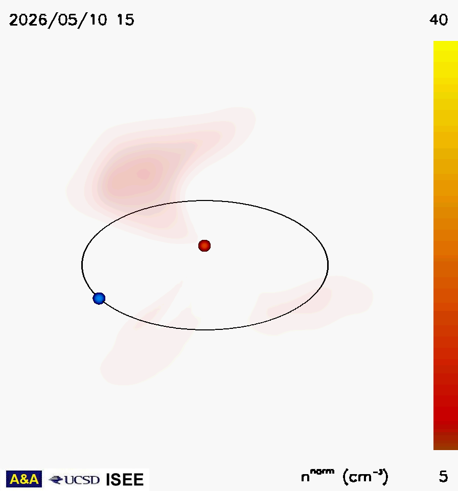
Density

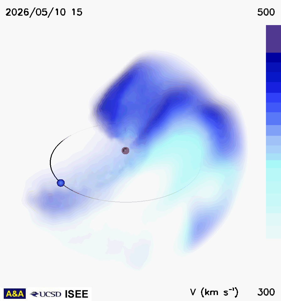
Radial Velocity
Most of these kinematic model analyses, in older formats using ISEE IPS data, can be found at: http://ips.ucsd.edu. A different kinematic model version is operated at the Korean Space Weather Center (KSWC). The analyses used to drive ENLIL in near real time can be found at George Mason University, and at the KSWC. An archive of these analyses can be found at: Real-Time Data (anonymous ftp images and data).
|
Remote Observer Views
|
|
Density
|
|
Radial Velocity
|
Remote views: of the density and radial velocity as an observer would view the heliosphere from a position 30 deg above the ecliptic plane and 45 degrees west of the Sun-Earth line. The orange dot in the center is the Sun, and the Earth is shown as a blue sphere on its orbit. Densities are normalized to 1 AU.
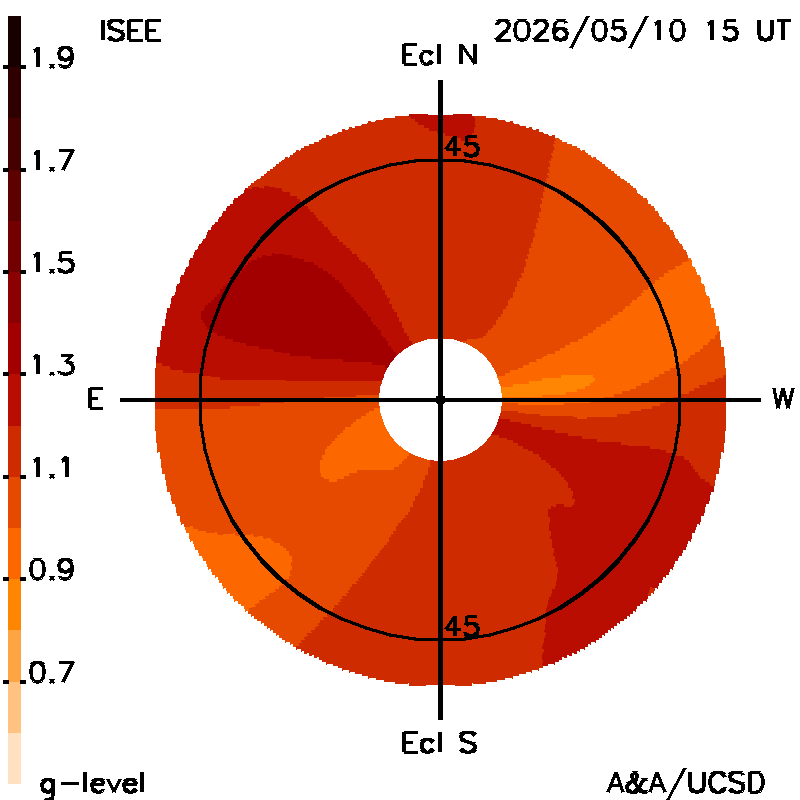
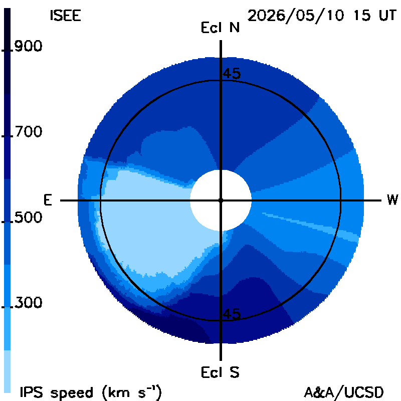
Fisheye views: views of g-level and radial velocity perpendicular to the line of sight as an observer would view the sky from Earth. The Sun is in the center of the plot, that extends to ~55 deg elongation away from it (the blank location at the plot center extends to 11.5 deg, the outward extent of strong scattering from the Sun; 45 deg is marked). The ecliptic is shown as a horizontal straight line.
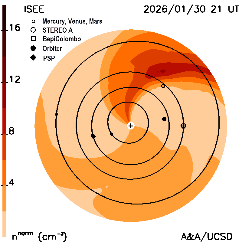
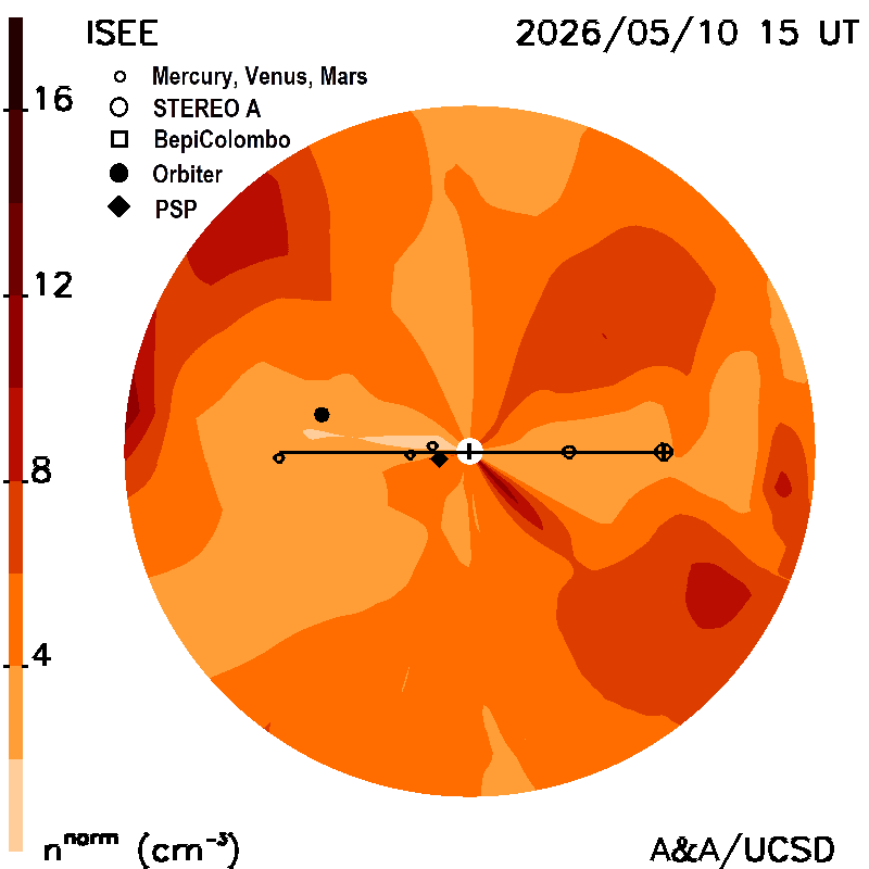
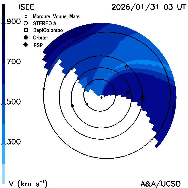
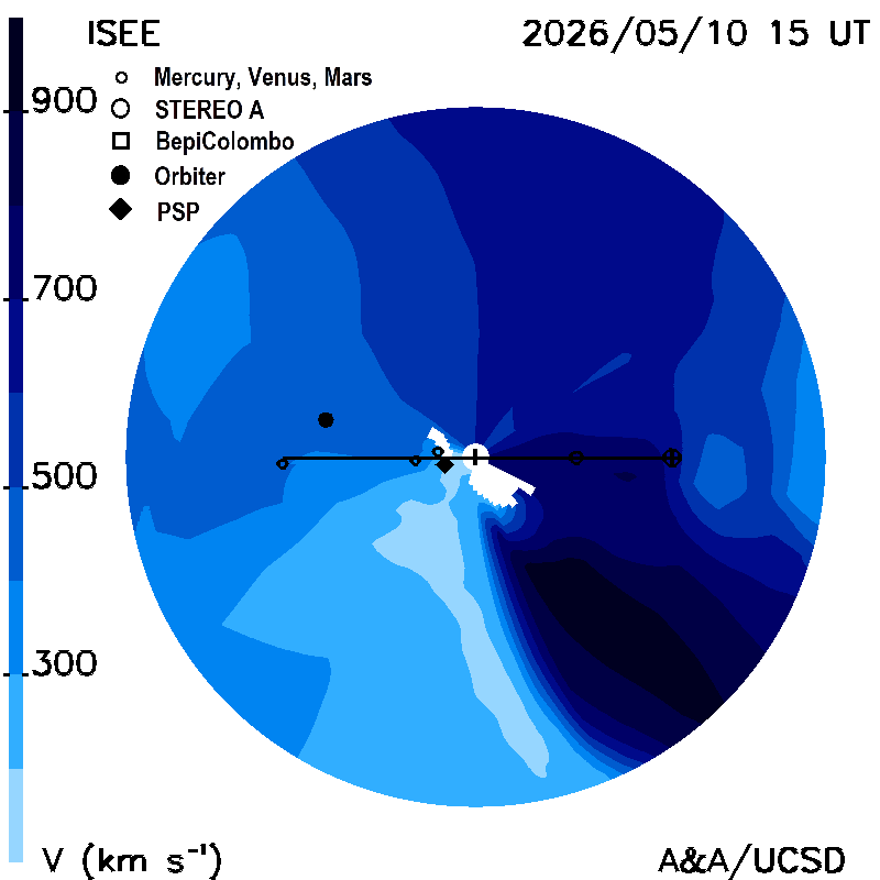
Planar cuts along the ecliptic: These show the density (normalized to 1 AU) and velocity, as planar cuts along the ecliptic within 6 hours of the current time. The Sun is in the center; Earth is shown in its orbit around the Sun. The maps are derived from a tomographic time-dependent model of the solar wind that is fit to interplanetary scintillation (IPS) velocities and g-levels obtained daily from ISEE, Japan. The model is updated every six hours.
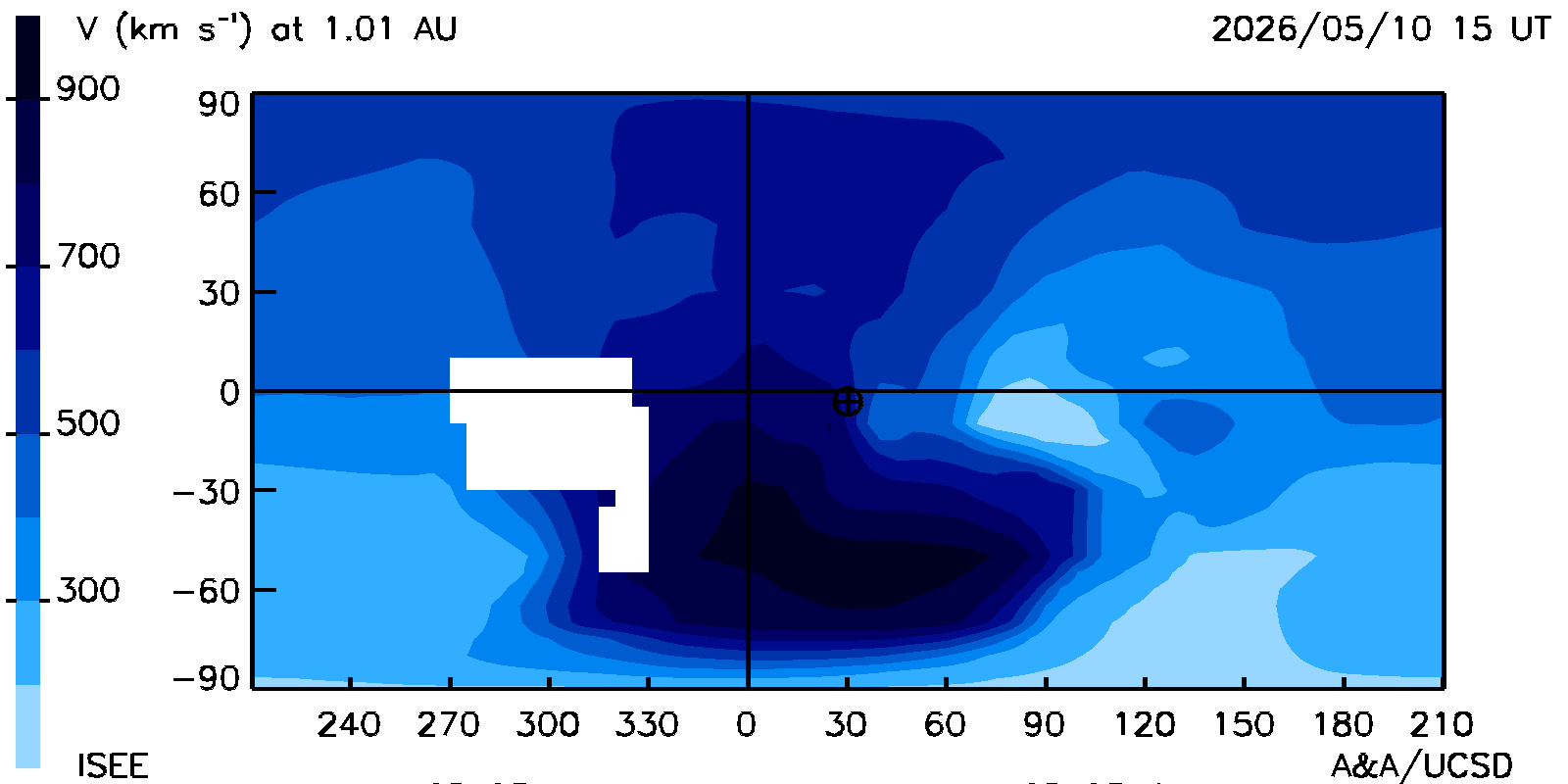
Planar cuts at the Earth's meridian: These show the density (normalized to 1 AU) and velocity as planar cuts along at the Earth's meridion at the same time as the ecliptic cuts. The Sun is in the center; Earth is shown on its orbit (a straight line) to the right of the image.
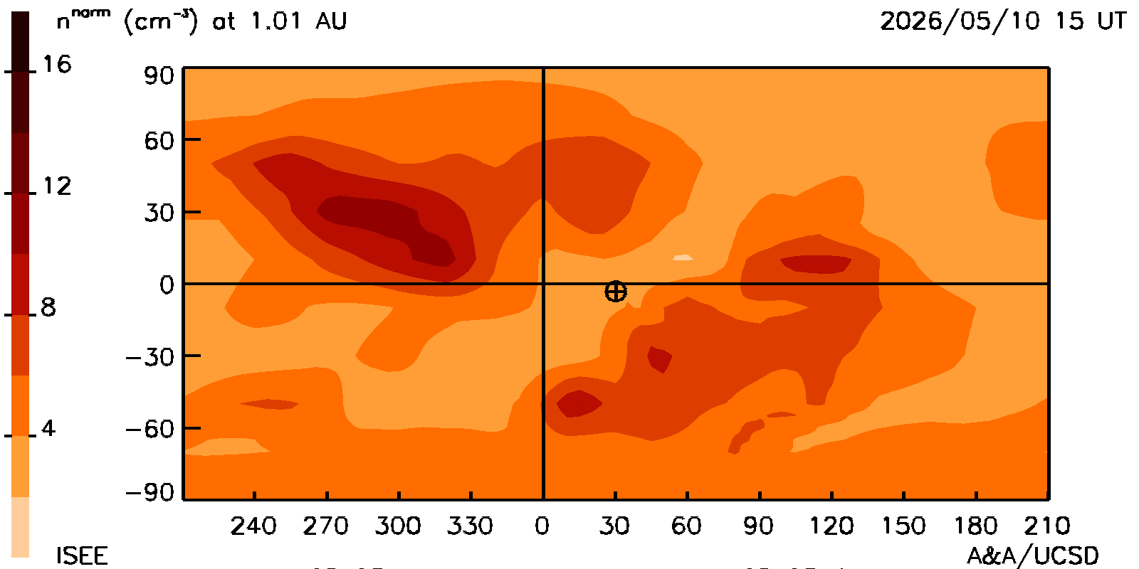
Carrington maps: Heliographic latitude and longitudional maps of density and velocity around the Earth at its distance from the Sun at the same time as the ecliptic and meridional cuts. The Earth is shown near the center of the plot.
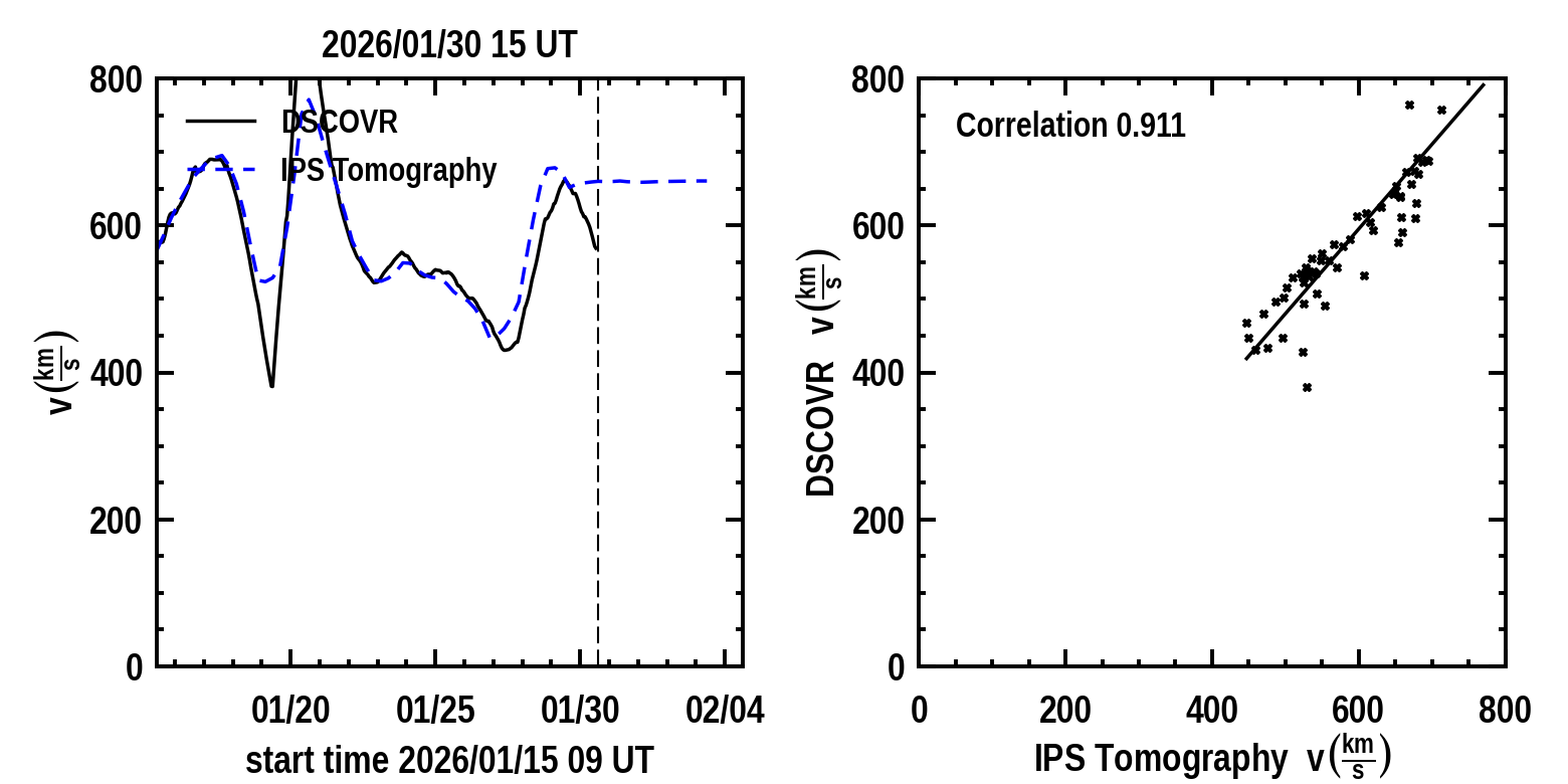
Time series plots: Near-Earth solar wind parameters density and radial velocity derived from the time-dependent tomography model (dashed curves) shown in comparison with Deep Space Climate Observatory (DSCOVR) spacecraft velocity and density (solid curves). A vertical dashed line indicates the GMT run time of the tomography program that is provided above the time series. The Pearson's "R" correlation between the model and observed values of each parameter are shown up to the time there are no more spacecraft data available. The time series is updated every six hours at the same time as the volumetric cuts. The prediction of the future parameter values begins at the location of the vertical dashed line where the observed values end.